The sierra high route is not a marked footpath you casually add to a long weekend. It is a demanding cross-country traverse through the Sierra Nevada, built around high passes, granite basins, talus, route-finding, and long stretches without a conventional trail under your boots. The reward is extraordinary mountain travel. The price is that you have to make good decisions repeatedly, often while tired, cold, and staring at terrain that looked simpler on the map.
I have watched plenty of well-equipped people get humbled by a route because they confused equipment with preparation. A new pack does not teach navigation. Expensive boots do not make loose granite stable. The trail finds the weak point, and on this route that weak point is usually judgment.
What the Route Actually Demands
The sierra high route is generally discussed as a roughly 190-mile Sierra Nevada traverse, though exact mileage depends on the line, alternates, access points, and side trips. It is commonly associated with Steve Roper’s route description, but it is not an official, continuously maintained trail. That distinction matters. You will use established trails in places, then leave them for cross-country travel over passes, slabs, boulder fields, and meadows.
Expect route-finding rather than simple trail following. A pass that looks obvious from a distance can have several gullies, cliffs, or unstable sections that make the first choice a bad one. Your daily mileage will not resemble a normal backpacking trip. Twelve miles over easy trail and twelve miles over broken granite are two entirely different workdays.
The sierra high route also demands comfort with uncertainty. Snow can linger near high passes well into summer. Smoke, afternoon thunderstorms, early-season runoff, and wildfire closures can change a plan before you reach the trailhead. Build a route that allows retreat instead of treating the original itinerary as a promise.
Planning the Line Before You Leave
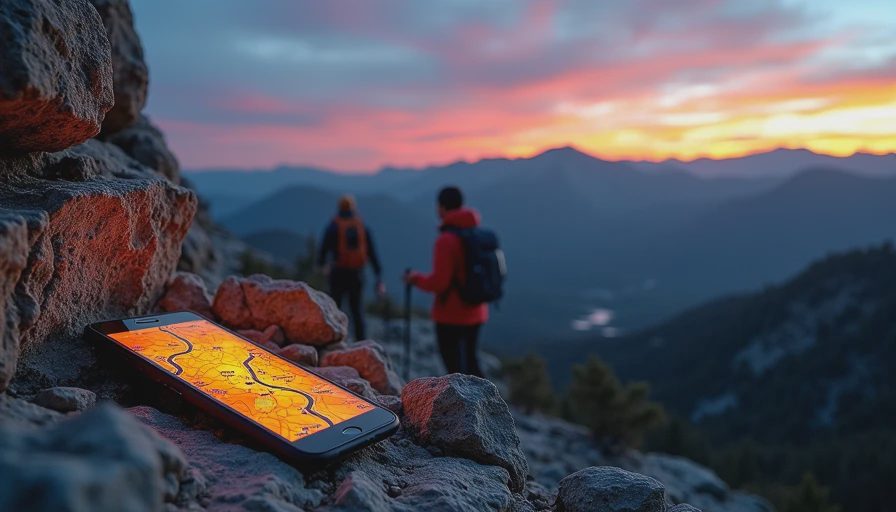
Start with topographic maps, recent satellite imagery, and at least one detailed route description. Gaia GPS, CalTopo, and paper USGS maps can work together, but none should be treated as magic. Download maps to your phone, carry a power bank, and bring a paper backup with the important passes and exit routes marked in advance.
The sierra high route becomes much more manageable when you divide it into decision points instead of thinking only about the finish. Mark trailheads, reliable water, possible camps, bailout valleys, and passes where weather could force a retreat. Tell someone at home which exits are realistic. “I will be somewhere in the Sierra” is not a useful emergency plan.
Permits and access rules require early attention. Depending on your direction and entry point, wilderness permits, quotas, overnight regulations, and campfire restrictions can affect the itinerary. Check current requirements with the managing land agency before departure, especially when crossing between national forests and national parks. A permit problem at the start is a poor way to begin a difficult trip.
Gear That Earns Its Weight
For the sierra high route, the best gear is not necessarily the lightest item in an online catalog. It is the item that still works when wet, dirty, cold, or handled by a tired person. Use a shelter that can handle Sierra wind, a sleeping bag or quilt appropriate for freezing conditions, and a sleeping pad with enough insulation for cold granite camps.
Footwear deserves more thought than branding. Lightweight trail runners can be excellent for dry trail and confident hikers, but stiff boots or more protective shoes may make sense for people carrying heavy loads across sharp talus. There is no universal answer. The right choice depends on ankle history, pack weight, snow conditions, and how efficiently you move over rough ground.
Bring trekking poles, a reliable headlamp, blister supplies, repair tape, a small first-aid kit, and extra food for delays. A satellite communicator is sensible because cell service is unreliable in mountain basins. Carry a water filter that can be field-cleaned, plus a backup treatment method. Do not assume every beautiful stream is automatically safe to drink.
The sierra high route punishes excess. A camp chair, oversized camera kit, duplicate clothing, and elaborate cooking system can turn a manageable load into a daily tax. A compact stove, simple meals, and a warm layer you can wear while moving usually beat comfort items that stay buried in the pack.
Water, Food, and Resupply Reality
Water planning is more complicated than drawing blue lines on a map. Snowfields can alter drainage, small sources can dry up, and a creek that looks dependable on a guide may be seasonal. Plan conservative carries around the longest dry stretches, then confirm conditions shortly before starting. On hot exposed traverses, carrying an extra liter can be more useful than shaving several ounces from your shelter.
Food should be boring in the best possible way. Choose meals you will eat when your appetite is high and your hands are cold. Tortillas, nut butter, jerky, hard cheese, instant rice, oatmeal, and calorie-dense snacks travel well. Test your food system on a shorter trip. Discovering that your stove clogs or your breakfast requires twenty minutes of fiddling is better done close to the truck.
Resupply is not something to improvise halfway through a remote traverse. Some hikers use a resupply box or arrange a town stop around the route, but every option introduces timing and access questions. Carry enough to handle a delayed exit, a weather hold, or a slower pace over difficult terrain.
Weather and Pass-Crossing Judgment
Weather is where the sierra high route stops being a scenic challenge and becomes a serious risk-management exercise. Start early when storms are possible, keep exposed ridges for stable conditions, and avoid becoming committed to a pass late in the day. Lightning, hail, cold rain, and sudden visibility loss can turn familiar terrain into a navigation problem quickly.
Snow travel requires particular caution. A pass may be technically open but still demand an ice axe, traction devices, and the skill to use both. Soft afternoon snow can hide holes near rocks and streams. Hard morning snow can create dangerous sliding terrain. If you do not have the training for the conditions in front of you, an alternate route is not failure. It is the correct call.
On the sierra high route, turning around can be harder emotionally than physically. You may have spent months planning the trip and days reaching a pass, but sunk effort does not improve a bad crossing. Set rules before leaving: maximum wind, lightning distance, poor visibility, or a partner who is no longer moving safely. Pre-made limits keep fatigue from making the decision for you.
A Better Way to Approach the Trip
Consider a shakedown trip before attempting the full traverse. Spend two or three nights on rugged terrain with the same pack, shelter, shoes, navigation setup, and food system. Pay attention to what rubs, rattles, leaks, or stays unused. My failure logs usually show that the problem was not one dramatic break. It was a collection of small annoyances that became expensive after several days.
A strong team also talks about pace and risk before the first climb. The fastest person should not quietly set the schedule, and the least experienced person should not feel pressured to hide concern. Stop at map breaks, confirm the next section, and speak up when the terrain no longer matches the plan. Looks ready and is ready are different things.
The sierra high route is worth the effort because it offers a kind of mountain travel that polished trail systems cannot duplicate. You earn each basin, pass, and camp through attention rather than horsepower or gear theater. Go light enough to move, prepared enough to wait, and humble enough to retreat. The best finish is not the photograph at the far end. It is getting home with good stories, functional feet, and enough judgment left for the next trip.


No comments yet — be the first to share a thought.